In an era saturated with digital information, the enduring appeal of maps remains potent. Beyond mere navigational tools, maps are profound artifacts that encapsulate historical narratives, societal values, and our evolving understanding of space. This article delves into the accessibility and significance of free USA maps, exploring their utility for academic research, educational purposes, and personal exploration of the United States of America.
Table of Contents
The Evolving Face of America: A Cartographic Journey
The history of cartography in the United States of America is intrinsically linked to the nation's expansion, exploration, and development. From early colonial surveys to the detailed topographical maps of today, each map tells a story. Early maps, often produced by explorers and surveyors, served vital functions: delineating territorial claims, identifying natural resources, and guiding westward expansion. Figures like Lewis and Clark, through their meticulously documented expeditions, produced invaluable cartographic records that shaped the nation's understanding of its vast interior.
The geological surveys and the establishment of government mapping agencies, such as the U.S. Geological Survey (USGS), revolutionized the accuracy and standardization of maps. These efforts provided a common geospatial framework, essential for infrastructure development, resource management, and national defense. The availability of these historical and contemporary maps, often accessible for free, offers researchers and enthusiasts an unparalleled window into the past.

"Maps are not merely abstract representations of territory; they are cultural products that reflect the intentions, biases, and knowledge systems of their creators."
Understanding the context of map creation is crucial. A map from the 19th century, for instance, might exhibit different border representations or feature place names that have since changed, reflecting the political and social realities of its time. Analyzing these differences allows for a deeper appreciation of historical shifts and the dynamic nature of our perception of geography.
Unlocking Knowledge: Maps as Academic Tools
For academics across disciplines—history, sociology, anthropology, political science, and environmental studies—free USA maps are indispensable resources. They serve as primary source material for understanding:
- Territorial Evolution: Tracking the acquisition of new territories, statehood processes, and border disputes through successive map editions.
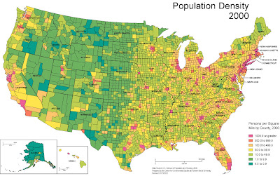
- Demographic Shifts: Analyzing population distribution, migration patterns, and the growth of urban centers over time.
- Infrastructure Development: Mapping the expansion of railroads, highways, canals, and communication networks that have shaped American connectivity.
- Resource Exploitation: Identifying the historical locations of mining, logging, and agricultural activities that have influenced economic development and environmental change.
- Cultural Landscapes: Understanding the spatial distribution of different ethnic groups, linguistic areas, and cultural practices.
The digital age has democratized access to a wealth of cartographic data. Government archives, university libraries, and dedicated online repositories now offer high-resolution scanned maps and geographic information system (GIS) data that can be downloaded and analyzed. This accessibility empowers researchers to conduct sophisticated spatial analyses without significant financial barriers.

When utilizing these resources, it's vital to consider the map's scale, projection, and intended purpose. A map designed for general overview will differ significantly from a specialized map focusing on soil types or voting patterns. Cross-referencing multiple map sources for the same period can provide a more comprehensive and nuanced understanding.
Teaching and Learning with Maps
Educators have long recognized the power of maps to engage students and illustrate complex geographical and historical concepts. Free United States of America maps provide a readily available tool for:
- Illustrating Historical Events: Mapping the routes of westward expansion, Civil War battles, or the locations of significant historical sites.
- Understanding Geographic Principles: Teaching concepts like latitude, longitude, scale, and map projections using familiar American geography.
- Developing Spatial Reasoning: Encouraging students to think critically about how physical geography influences human settlement and activity.
- Engaging with Current Events: Using contemporary maps to understand political boundaries, resource distribution, and environmental issues impacting the USA.
Interactive maps and online atlases can transform passive learning into an active exploration. Students can zoom in on specific regions, overlay different data sets, and even create their own simple maps to demonstrate their understanding. This hands-on approach fosters a deeper connection with the subject matter.
"A good map is a gateway to understanding; a bad map can lead one astray, both physically and intellectually."
By providing students with access to diverse map types, educators can cultivate critical thinking skills. They learn to question the information presented, identify potential biases, and understand that maps are interpretations, not absolute truths.
DIY Cartographic Exploration: Utilizing Free Resources
The "Do It Yourself" ethos extends beautifully to the world of cartography. With the abundance of free resources available online, individuals can embark on their own explorations of American geography and history. Here’s a practical guide to getting started:
- Identify Your Objective: What do you want to learn or visualize? Are you interested in the historical routes of the Oregon Trail, the distribution of national parks, or the evolution of major city boundaries?
- Locate Reputable Sources: Start with established institutions like the U.S. Geological Survey (USGS), the National Archives and Records Administration (NARA), the Library of Congress, and university digital map collections. Search for terms like "free USA maps download," "historical American maps," or "USGS topographic maps."
- Download and Inspect Maps: Most modern topographic maps and many historical scans are available as high-resolution digital files (e.g., GeoTIFF, PDF, JPEG). Download maps relevant to your area of interest. Pay attention to the map's legend, scale bar, and north arrow.
- Use Digital Tools (Optional but Recommended): For deeper analysis, consider using free GIS software like QGIS. This allows you to overlay different map layers, measure distances, analyze spatial patterns, and even create your own thematic maps. Many online platforms also offer simple map-making tools.
- Cross-Reference Information: Never rely on a single map. Compare maps from different sources and time periods to get a more accurate picture. Look for corroborating evidence in historical texts or other geographical data.
- Create Your Own "Map Story": Document your findings. This could be a blog post, a presentation, a series of annotated maps, or even a physical collage of historical map excerpts. The goal is to synthesize your exploration into a coherent narrative.
- Explore Historical Map Databases: Websites like the David Rumsey Map Collection or the Library of Congress's online map portal offer vast archives of historical maps that can be browsed and downloaded. These are invaluable for tracing the historical development of any region within the United States of America.


The act of creating or deeply analyzing a map can transform a passive observer into an active participant in understanding spatial relationships and historical change.
Frequently Asked Questions
What are the best sources for free USA maps?
Reputable sources include the U.S. Geological Survey (USGS) for topographic maps, the National Archives and Records Administration (NARA) and the Library of Congress for historical maps, and various university digital map collections. Many state geological surveys also offer free downloadable maps of their respective states.
Can I use these free maps for commercial purposes?
It depends on the specific license. Maps produced by U.S. government agencies are generally in the public domain and can be used freely. However, always check the licensing terms for maps from other sources, especially those compiled by private entities or academic institutions.

How do I interpret historical maps?
Understand the context of creation: who made it, when, and why? Note the map's projection, scale, and symbols. Compare it with modern maps and historical texts to identify changes in borders, place names, and features. Historical maps are interpretations reflecting their time.
What is the difference between a topographic map and a standard road map?
Topographic maps show the Earth's surface relief using contour lines, indicating elevation and landforms. They also depict natural and man-made features like rivers, forests, roads, and buildings. Standard road maps primarily focus on transportation networks and political boundaries, offering less detail about terrain.

Conclusion: Mapping Our Understanding
The availability of free USA maps represents a significant democratization of geographic and historical knowledge. These resources empower students, researchers, educators, and curious individuals alike to explore the intricate tapestry of the United States of America. From tracing the physical transformations of the land to understanding the societal forces that shaped its boundaries and settlements, maps offer a unique and invaluable perspective.
By engaging with cartographic resources, whether through simple observation or complex spatial analysis, we not only learn about the past but also enhance our understanding of the present spatial dynamics that continue to shape our world. The act of exploring these maps is, in itself, a journey of discovery, a testament to the enduring power of cartography in making sense of our place within the grander geographical and historical narrative.
